


Inverness Voting District, Sunflower County, Mississippi
About
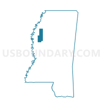
Outline

Summary
| Unique Area Identifier | 606700 |
| Name | Inverness Voting District |
| County | Sunflower County |
| State | Mississippi |
| Area (square miles) | 106.15 |
| Land Area (square miles) | 103.89 |
| Water Area (square miles) | 2.26 |
| % of Land Area | 97.87 |
| % of Water Area | 2.13 |
| Latitude of the Internal Point | 33.34219170 |
| Longtitude of the Internal Point | -90.60199650 |
Maps


Graphs
Select a template below for downloading or customizing gragh for Inverness Voting District, Sunflower County, Mississippi


Neighbors
Neighoring Voting District (by Name) Neighboring Voting District on the Map
- Four Mile Voting District, Humphreys County, MS
- Indianola 2 East Voting District, Sunflower County, MS
- Indianola 2 West Voting District, Sunflower County, MS
- Indianola Southeast Voting District, Sunflower County, MS
- Isola Voting District, Humphreys County, MS
- Moorhead Voting District, Sunflower County, MS
- Morgan City/Swiftown Voting District, Leflore County, MS
- North Belzoni Voting District, Humphreys County, MS
Top 10 Neighboring County Subdivision (by Population) Neighboring County Subdivision on the Map
- District 5, Leflore County, MS (7,421)
- District 1, Sunflower County, MS (5,703)
- District 2, Sunflower County, MS (5,147)
- District 2, Humphreys County, MS (1,903)
- District 1, Humphreys County, MS (1,618)
Top 10 Neighboring Place (by Population) Neighboring Place on the Map
Top 10 Neighboring Unified School District (by Population) Neighboring Unified School District on the Map
- Leflore County School District, MS (16,094)
- Indianola School District, MS (11,488)
- Sunflower County School District, MS (10,540)
- Humphreys County School District, MS (9,375)
Top 10 Neighboring State Legislative District Lower Chamber (by Population) Neighboring State Legislative District Lower Chamber on the Map
Top 10 Neighboring State Legislative District Upper Chamber (by Population) Neighboring State Legislative District Upper Chamber on the Map
- State Senate District 22, MS (48,806)
- State Senate District 13, MS (46,404)
- State Senate District 24, MS (45,527)
Top 10 Neighboring 111th Congressional District (by Population) Neighboring 111th Congressional District on the Map
Top 10 Neighboring Census Tract (by Population) Neighboring Census Tract on the Map
- Census Tract 9503, Leflore County, MS (5,792)
- Census Tract 9505, Sunflower County, MS (2,999)
- Census Tract 9501, Humphreys County, MS (2,636)
- Census Tract 9502, Humphreys County, MS (2,574)
- Census Tract 9506, Sunflower County, MS (2,571)
Top 10 Neighboring 5-Digit ZIP Code Tabulation Area (by Population) Neighboring 5-Digit ZIP Code Tabulation Area on the Map
- 38751, MS (11,638)
- 39038, MS (6,258)
- 38761, MS (2,870)
- 38754, MS (1,532)
- 38753, MS (1,456)
- 38946, MS (362)
- 38958, MS (38)